Here's the route:

I started with a bit of a warm up and then turned and headed back to the Alpe - as I was only going 5 bends to 16 I just plodded up and turned off at 16 as planned. The change in character from the Alpe climb to the much smaller D211A was significant, and was flat for a mile or so. However it then started to climb shortly after crossing the Sarenne and kept going up for some distance, firstly through pleasant tree lined roads and a few hamlets but a few miles later became a barren alpine road, cut into a sheer cliff on one side and, other than a small wall, a sheer drop on the other, there were even some tunnels.To the right you could look down on the river valley of Bourg d'Oisins from a great height. (Later we'd try and spot the road from the valley below and its almost invisible, unless there's a car moving its almost impossible to spot the road).
Here's some pictures from my Virb:


I took a video of a little of the climb, and I also descended via this route later in the holiday and took a video during the descent as well. These Videos are here:
The ascent:
The descent:
I'd not quite anticipated the level of climbing on this road and took it very steady to keep some energy in reserve. Once at the top the route was rolling for a few km for a steep drop with a number of hairpins to the village of Le Freney-d'Oisins. It was then back onto the D1091 towards the reservoir and dam of the Lac du Chambon. This (bigger) road was a good surface, and because of the landslip further along was basically traffic free. The gradient was gentler as well so the pace went up. There were a few tunnels along this part of the road and the exit of the final tunnel led straight to the dam. Here's a short video:
Immediately across the dam the lakeside road was closed (this affected the 2015 Tour de France route) and I turned left straight to a 10% gradient for a couple of km to the village of Motzoen. This was a really tough climb for some reason - the temperature was rising as well so it was hot. The road continued to climb through Clavans-le-Bas and then Clavans-le-Haut and here we were on the "Route du Col de Sarenne". The heat seemed to build and the gradient was unrelenting. As I went higher I passed the last village/hamlet of Le Perron and here the last of the tress disappeared and the landscape became quite barren. In addition the gradient changed from 6-8% to more like 8-10%. I'd managed to hang in the 34-28 gear as the lowest up to this point but from here I needed to use the 34-30 gear more often.
Because the trees had gone so the temperature rose and I got hotter as the sun heated me up and the gradient stayed high. I was getting through my water quite quickly by now - both to drink and to use some over my head and back to try and keep cooler. I was passed by one other cyclist going up and several going down. The road surface was not great but at the low speed I was climbing this was not a problem - although the descenders were very cautions. I continued to climb but it was incredibly hard work. Eventually I could stat to see what I believed must be the top and I got a lift - up to that point I was thinking that I was going to need to stop and the rate I was getting through water was starting to make me quite concerned that I was going to run out. It took a further 20 minutes or so from seeing the top to reach it and I was extremely grateful. There was almost nothing at the top though - a small sign and what looked like a ski lodge with 2 cyclist sitting outside. I wobbled along 50m or so of gravel track and sat at a bench. A woman came out and after clearly a non-French "Bonjour" from me she realised that I was English - the outcome was a cup of coffee and a slice of apple pie and ice cream, and a jug of water which resulted in full bottles:
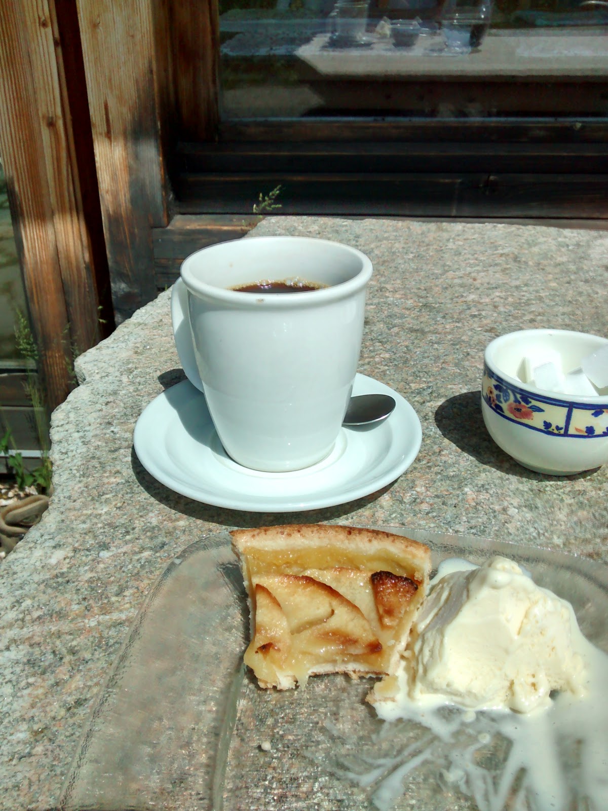 |
| Welcome refreshments at the top of the Col de Sarenne |
 |
| View southwards from the top of the Col de Sarenne |
 |
| Knackered! |
I had under estimated the ride for this day. With the climb not being in "the book" to contextualise the difficulty it was a case of take what comes - and it was very hard. I was also concerned about how close I'd come to running out of water and as a result for subsequent rides I stopped and stopped and topped up my bottled whenever I saw an "Eau potable" tap.
No comments:
Post a Comment